Mystery of Sulfuric Hot Water at Roswar Island
Air bubbles on the coast of Roswar Island, Wondama Bay, West Papua, no longer capture the attention of local residents.
...
Air bubbles on the coast of Roswar Island, Wondama Bay, West Papua, no longer capture the attention of local residents. Neither does the warm sulfuric river flowing from the forest into the sea.
Local resident Markus Wandau, 60, sees it as a common natural occurrence. Uninterested, he stayed on the speedboat while taking the Kompas team to enjoy the warm waters on Nov. 8.
Benyamin Sapiie, dean of the geology faculty at the Bandung Institute of Technology, had a different response when he heard about the presence of air bubbles and sulfuric warm water.
The academic, who conducted research several times at Cenderawasih Bay, said it was a unique phenomenon. The presence of sulfuric hot water is related to volcanic activity. In fact, in Papuan soil, volcanoes are only found in New Guinea, far from Roswar Island (formerly Mioswar Island).
“If there is sulfur, we suspect there could be a volcano. [We thought] there were no volcanoes [in Papua] because tectonically it could not create a volcano. If there is [a volcano] down there, perhaps we were wrong. Maybe it is beyond our analysis,” said Benyamin, after looking at Kompas\' findings.
Regarding the air bubbles on the coast, his analysis was similar to the hypothesis from Energy and Mineral Resources Ministry sea geology development and study researcher Susilo Hadi. “The bubbles may be the result of broken tectonic plates deep under the sea,” he said.
However, Ludi Parwadani Aji, from the technical implementation unit for marine biotic conservation at the Indonesian Institute of Sciences’ Oceanography Research Center (P2O LIPI) hypothesized that the bubbles in the muddy coastal seafloor were methane and was a byproduct of bacterial metabolism in organic compounds.
Formation process
The formation process of Papua was unique. One theory says million of years ago, it was attached to Australia. Papua, which moved away due to a shift of the plate, is still moving counterclockwise to gain stability. The northerly movement made the area prone to earthquakes. One positive outcome, though, is that it resulted in valuable minerals, such as cobalt.
Moreover, this movement is the basis of the theory that in the past 14 million years, the “mouth” of Cenderawasih Bay has almost closed up twice. Around 10 million to 14 million years ago, part of Halmahera Island (Maluku) was in front of Cenderawasih Bay, which then moved away due to pressure from the plates.
There are at least five models showing the formation of Cenderawasih Bay 252 million years ago, 66 million years ago, 25 million years ago, 10 million years ago and the present era.
Those five models are grouped into two shifting models: a plate shifting model; two shifting models with a rotating plate; and one model, which is a combination of movement and shifting or a rotation pattern. Benyamin’s hypothesis is based on the last model. “That [last model] is my contribution in explaining the origin of Cenderawasih Bay,” he said.
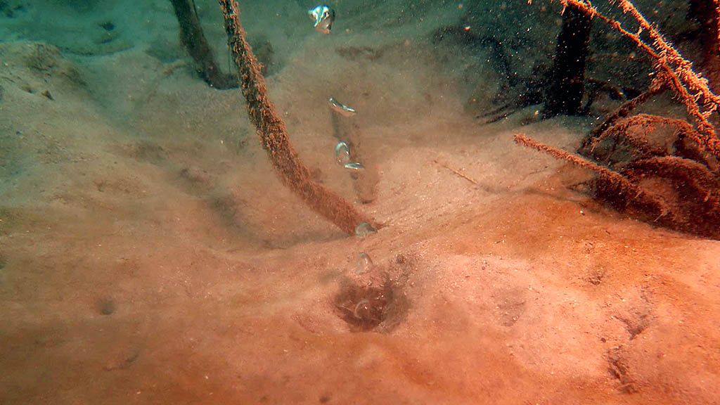
The waters around Waprak village in Mioswaar or Roswar Island in Wondama Bay, West Papua, have an interesting natural phenomenon. The bottom of its mud substrate, on which seagrass grows, emits hot air bubbles, while hot water flows in the nearby river. This phenomenon is interesting for researchers because no volcanic activity has been found in Papua. It is believed that it is caused by the pressing of plates. The area is included in the Cendrawasih Bay National Park limited-utilization zone.
Global attention
Cenderawasih Bay is characterized by a V-shape that affects the tectonic history of the Kepala Burung (Bird’s Head) area. The V-shape of Cenderawasih Bay remains an unanswered question for geology experts around the world. At international seminars, Benyamin said, geologists often asked about it. Moreover, geologists have detected eclogite at the end of the Wandamen peninsula, which should be 25 kilometers below the earth’s surface.
“Yet those rocks are found in the bay, which was formed only 2 million years ago,” he said. At this bay, the water is between 1,000 and 2,000 meters deep some 20 km from the coastline. “It is like a lake in the sea. What was the formation like?” he asked.
In his scientific paper, he wrote that Cenderawasih Bay contains hydrocarbon components, specifically in the area opposite it in Bintuni Bay, where gas reserves have been exploited and processed. Several oil and gas companies have conducted seismic surveys in the area.
Suharsono, a marine biology professor from P2O LIPI, said Cenderwasih Bay saw four decreases in sea level, all occurring between 11,000 and 600,000 years ago during the Last Glacial Maximum. The inundation period due to the geological process isolated the surrounding biota, which then evolved into unique species.
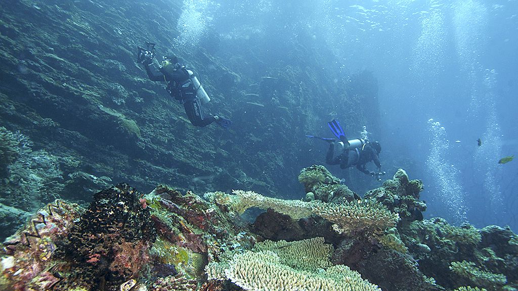
A survey of marine potential in Cenderawasih Bay National Park by WWF Indonesia, TNC Indonesia and CI Indonesia in 2006 showed 716 types of coral reefs, of which 11 or 12 are new species and 8 are endemic. Meanwhile, there are 506 types of coral animals, slightly less than Raja Ampat with 540 types.
In the same survey, it also found sites with the highest coral diversity (178 types), compared to Raja Ampat (131 types). Further studies showed Cenderawasih Bay National Park is home to 950 species of coral fish as well as some large fauna such as whales, dolphins, dugongs and whale sharks.
According to the report Endemic Marine Species of the Bird’s Head Seascape by Dr. Mark Erdmann and Dr. Gerald Allen (2014), there are 35 species of endemic coral fish in Cenderawasih Bay. With the five more found earlier, that makes 40 coral species as well as eight endemic types of shrimp.
Due to the uniqueness of the territory and ecosystem, it was not wrong to designate Cenderawasih Bay a national park in 2002.