\'Kai-Tak\' Tropical Cyclone Approaching Indonesia
By Thursday morning (21/12), the Kai-Tak tropical cyclone will be 365 kilometers northeast of Natuna, continuing to approach Indonesia.
By
·4 minutes read
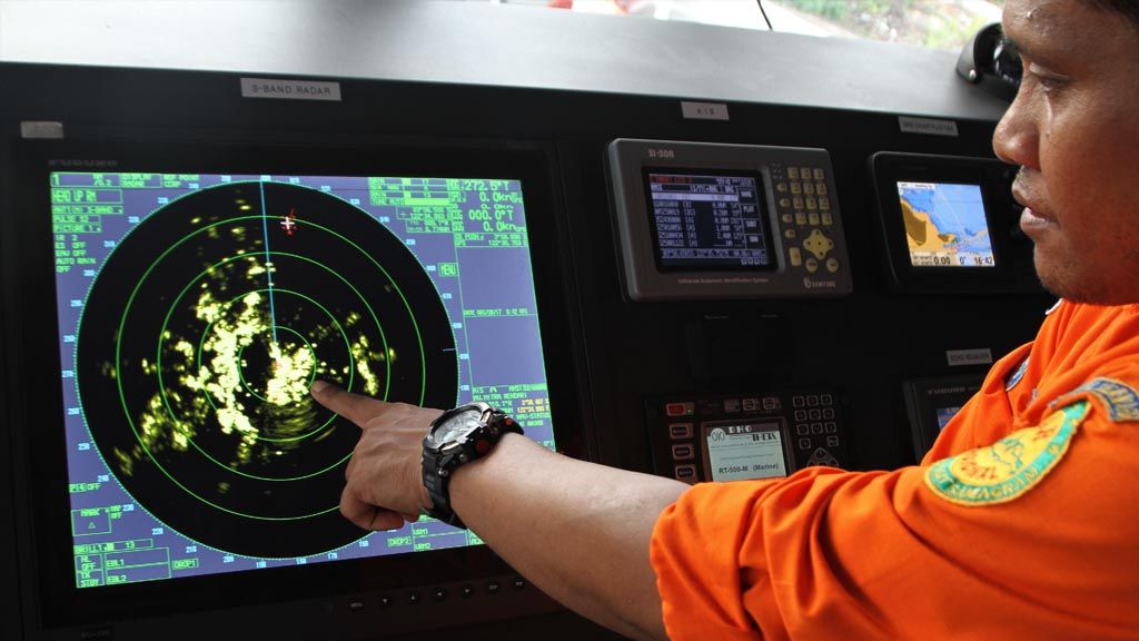
Antara Foto/Jojon
A National Search and Rescue Agency (Basarnas) personnel points to an image on a navigation radar aboard the KN Pacitan that monitors the movement of ships and the weather on Wednesday (20/12), at the Basarnas Kendari dock in Southeast Sulawesi. Basarnas Kendari has readied 108 personnel and emergency vehicles on special alert for the yearend holiday, including the KN Pacitan and other vessels, to anticipate the possibility of disasters affecting tourist destinations.
JAKARTA, KOMPAS – After the Dahlia and Cempaka cyclones came and triggered floods and landslides at the end of November, the Kai-Tak cyclone is now moving towards Indonesia. This tropical cyclone is expected to bring with it medium to high rainfall that could hit North Kalimantan, northern East Kalimantan and northern Central Kalimantan.
An early warning issued on Wednesday (20/12) by the Jakarta Tropical Cyclone Center of the Meteorology, Climatology and Geophysics Agency (BMKG) said that whirlwinds from the Kai-Tak tropical cyclone, which had weakened and become a tropical depression, had regained strength to become a cyclone again.
On Wednesday morning, the Kai-Tak tropical cyclone was located about 700 kilometers northeast of Natuna and approaching Indonesia in a southwesterly direction at 17 kilometers per hour. It has been forecasted that by Thursday morning (21/12), the cyclone will be 365 kilometers northeast of Natuna, continuing to approach Indonesia.
Other than heavy rain, BMKG extreme weather and climate researcher Siswanto said the tropical cyclone would also triggers high seas. Waves as high as 4-6 meters could appear in the waters of the Anambas and Natuna Islands. Waves categorized as extreme, which can reach more than 6 meters in height, could appear in the North Natuna Sea. In southern Makassar, waves 2.5-4 meters high have been predicted.
The cyclonic circulation in the Banda Sea and in the Indian Ocean southwest of West Java has caused a low-pressured trough in southern West Nusa Tenggara (NTB).
A local resident has been reported missing, swept away by the river in Malaju village, Kilo district.
Yesterday, strong winds hit Mataram City on Lombok Island, NTB. Based on the data from the Lombok International Airport Meteorology Station, surface wind reached speeds of 27 knots, or about 50 kilometers per hour.
A number of trees fell in Mataram, but no lives were lost. A tree on the Mataram University campus, for example, fell and crushed two motorcycles that belonged to its students.
In addition to strong winds, heavy rain also hit areas of Bima regency yesterday. Though it did not cause flooding, Agung Pramuja, from the NTB Regional Disaster Mitigation Agency’s emergency response unit, said the heavy rain increased the river water discharge. A local resident has been reported missing, swept away by the river in Malaju village, Kilo district.
Changes
The stronger frequency and intensity of tropical cyclones indicates a change in weather dynamics. The World Meteorology Organization (WMO) pointed out that global meteorology is entering a new era of higher-impact extreme weather that can trigger disasters.
After the Dahlia and Cempaka cyclones caused floods and landslides at the end of last month, Indonesian weather will again see high potential of heavy rain and strong winds to the turn of the year. While it may not be as extreme as before, people that will be traveling over Christmas and New Year need to watch weather conditions.
“The weather temperature and climate have changed in line with changes in the climate. In Indonesia, the effect is signaled by the coming tropical cyclones, which continue to move closer to Indonesian territory,” said Dodo Gunawan, head of the BMKG’s Climate Change Information Center.
According to Dodo, the edge of the cyclone is positioned 10 degrees latitude north and south. That is why Indonesia is deemed safe from the direct impact of the cyclone.
“However, this is a reminder that tropical cyclones will be going beyond its climatologic latitude limits more frequently in the future,” he said. “The impacy was felt when the Cempaka and Dahlia cyclones struck. Extreme rain triggered floods in many areas,” he said.
Throughout 2017, 25 tropical storms, 32 tropical cyclones and 11 strong tropical cyclones of category 3 were recorded.
Siswanto said that a significant increase in extreme weather frequency was observed in the West Pacific, between the eastern Philippines and northern Papua. Throughout 2017, 25 tropical storms, 32 tropical cyclones and 11 strong tropical cyclones of category 3 were recorded. In comparison, data from 1965-2016 shows that the same area had only seen an average 26 tropical storms, 16 tropical cyclones and nine strong tropical cyclones.
Rainfall pattern
Long-term changes in Indonesian weather were also marked by changes in temperature and rainfall. Siswanto and Supari studied the data on long-term changes in rainfall pattern in 2016.
“The El Nino weather phenomenon in the Pacific Ocean has also changed. In the past, it generally occurred along the eastern Pacific equator, but since the 1990s, it has dominated the central Pacific more. This results in a changed impact in Indonesia,” Siswanto said.
The WMO issued a warning on Dec. 13 that meteorology was entering a new era of increased rate of global disasters from typhoons, floods and droughts. The situation demanded an improvement in surveillance and weather prediction capabilities.
This global environmental change, according to the WMO, has caused an increase in risk. In 2016, insurance companies around the world reported that losses incurred by disasters totaled US$175 billion, with 75% caused by hydrometeorology disasters.