Despite flooding being a routine occurrence in Jakarta, the city remains ill-prepared to deal with recurrent disaster.
By
·3 minutes read
Kompas/Irene Sarwindaningrum
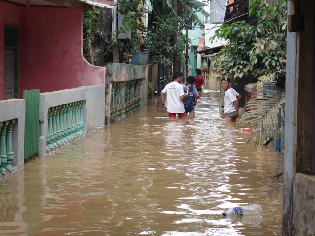
The overflow of water from Ciliwung River that had inundated Rawa Sepat in the area of Cililitan Kecil, East Jakarta, began to subside on Tuesday (6/2) afternoon. Floods in the densely populated area had reached a depth of two meters on Monday, forcing residents to evacuate.
JAKARTA, KOMPAS – Despite flooding being a routine occurrence in Jakarta, the city remains ill-prepared to deal with recurrent disaster. Some flood-prone areas are still excluded in the city’s disaster preparedness masterplan, such as Kampung Rawa Sepat near Cililitan Kecil in East Jakarta.
An overflow of water from the Ciliwung River flowing into the densely populated area through culverts inundated people’s homes at around 6 p.m. on Monday (5/2/2018). As night arrived, the water reached a depth of 2 meters in some parts.
This came unexpected for locals, who had not received any flood warning. In the last two years, ever since the dismantling of the Kalibata Bridge that used to accumulate trash and trigger flooding, the kampung has never been inundated by more than 10 centimeters of water.
“Before the bridge was dismantled, there used to be floods every year,” said Syahrul, who inhabits one of the houses now flooded.
Other inundated areas are Rawajati and the Kampung Melayu subdistrict in East Jakarta, one of the areas worst affected by overflow from Ciliwung River.
By Tuesday (6/2) at around 1 p.m., the water had reached a depth of 130 cm in some parts of the area. Kampung Melayu resident Roy, 29, said the water level had reached more than 190 cm on Sunday night.
Begging on the streets
As they had yet to receive any aid, around a dozen flood victims begged motorists passing through the area for help. Children and adults alike held up cardboard boxes or glass jars to drivers.
“I cannot sell and I don’t have any money. I only get rice assistance,” said Usna, 42, one of those begging on the streets.
The Jakarta Social Affairs Agency and Disaster Response Team erected evacuation tents and distributed aid to flood victims on Tuesday afternoon. Locals were urged to refrain from erecting shelters on sidewalks and begging motorists for help.
As a city traversed by 13 rivers, Jakarta has a map of flood-prone areas but no disaster evacuation map.
“Jakarta needs to have this immediately,” Ciliwung-Cisadane Flood Control Office (BBWSCC) head Jarot Widyoko said. Urban development expert Nirwono Joga agreed:
“The Jakarta administration only focuses on flood issues when floods occur. As soon as the floodwater subsides, so does any interest in resolving the matter,” Nirwono said.
One of the reasons why the city has no disaster evacuation map is the fact that the spots most affected by floods change frequently.
Jakarta Governor Anies Baswedan told reporters that the administration was prioritizing support for flood victims over any plans to normalize the Ciliwung watershed area.
“Once the disaster response is completed, we will talk [about normalization]. That is for later,” Anies said after visiting flood evacuees in Kampung Melayu. He said the flood victim management was going well.