Misery of Mangroves in Youtefa Bay
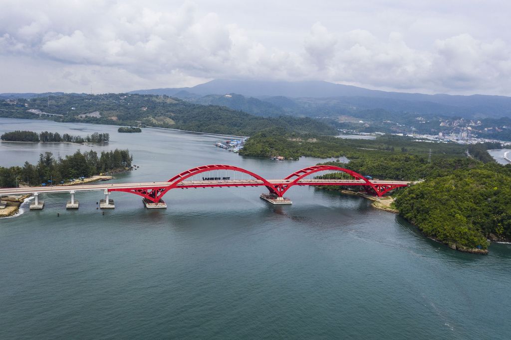
The presence of Youtefa Bridge and the Trans-Papua Highway over Youtefa Bay in the city of Jayapura, is invigorating the area’s economic activity. On the other hand, the bridge and highway have also destroyed forests.
The waters of Youtefa Bay in Jayapura city, Papua, were muddy and brown that afternoon. Plastic waste like used water bottles and liquor containers crowded the edge of the pier. The pervading smell of sewage in the air completed that murky afternoon in early December 2021.
At the edge of the pier, a senior high school student was turning his boat around. He was going home to Enggros village, located in the middle of Youtefa Bay.
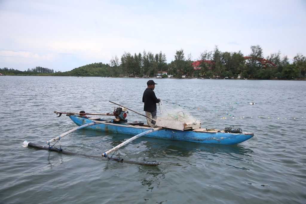
Before the 2000s, Enggros fisherman Rudi Iwo, 58, said the waters around Youtefa Bay and the pier were still clear. From aboard his boat, Rudi could see fish the size of an adult’s arm.
At the time, the fishermen’s catch was still big. Sailing around the bay, said Rudi, his boat might sink from the weight of the huge catch. “If just 100 mackerels were caught, the boat would go down,” he recalled.
“Mangroves for us are like a shopping mall. Fish and shrimps spawn there.”
Over a decade has passed, and the fishermen’s catch has decreased. The construction of the highway and bridge in the area has reduced the mangrove forest. The quantity of fish has also declined.
Rudi’s trap net, even after it had been set up and left for a whole night, sometimes caught only a pail of young anchovies. Before, when the bay’s ecosystem was still intact, the father of three could harvest up to 10 buckets of anchovies.
“In the past, the materials [supplies, like gasoline] were lacking but the fish were abundant. Now, many materials are available, but the fish are getting scarce,” he said.
Rudi therefore no longer relies on fishing to make a living. At the weekend, he drives a sea taxi to transport tourists to C'berry Beach, a tourist spot on Youtefa Bay. If he is lucky, he can get two or three tourists. The rate for sailing around Enggros village is around Rp 300,000 per trip.
Yosias Hababuk, a fisherman from Enggros village in the Youtefa Bay area, has the same experience. On meeting him at 1:20 p.m. Eastern Indonesia Time (WIT) that same day, the 43-year-old fisherman was checking his net.
Under the blazing sun, Yosias only found 30 fish in his net, which he had set up for two hours in Youtefa Bay. Now and again, he found plastic waste caught in his net.
Yosial usually sells the fish he has caught to several customers who own food stalls in South Jayapura district and at Hamadi Market.
“These days, I find a lot more waste in Youtefa Bay than fish. This condition is very different from when I set out to sea 10 years ago. I could catch hundreds of fish every time I went fishing,” said the father of two.
According to data from the garbage and hazardous and toxic (B3) waste management division of the Jayapura Municipal Environment and Sanitation Office, Jayapura produces 253 tons of waste per day, but the city can only handle 215 tons of waste.
“The waste that cannot be handled stays in the drainage canals, rivers and [marine] waters of Jayapura. This is due to the poor awareness of residents about disposing their waste in the proper place,” said Agustinus Ondi, the head of the Jayapura Environment and Sanitation Office’s garbage and B3 waste management division.
Major impact
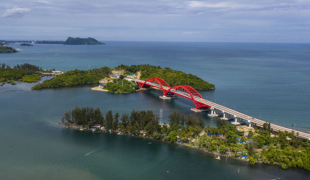
Today, Youtefa Bay is classified as a nature tourism park that is under the management of the Papua Natural Resource Conservation Center, while the mangrove forests in the area are a protected forest under the authority of the Papua Forestry and Environment Agency. There are three traditional villages in the area: Tobati, Enggros and Nafri.
According to former Enggros village head Orgenes Merauje, the impacts of infrastructure development in the Youtefa Bay area is like two sides of a coin. The Youtefa Bay Red Bridge and the Jayapura Ring Road has enabled the people of Enggros village to engage in the tourism sector since 2015.
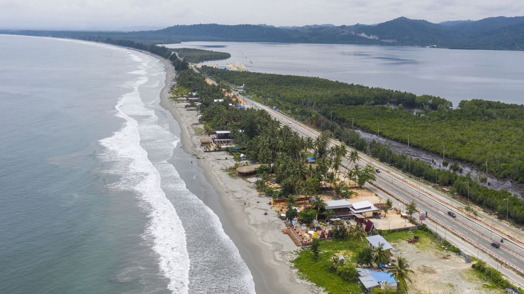
The local income from the tourism sector is very promising. The manager of a tourist spot on Hecnuk Beach, near the Red Bridge claimed that he could earn up to Rp 12 million per day during the peak tourist season.
Part of the money comes from renting out cottages. He owns 14 cottages, renting them out for Rp 300,000 each. His income comes not only from these cottages, but also from selling food and drink, as well as toilet facilities, for which he charges Rp 10,000 per person.
On the other hand, he said, the Red Bridge offered smooth access for Enggros villagers. Students heading to school or university did not need to find boarding rooms near Jayapura, and could instead live at home in their village.
Nevertheless, the development has come with a price. The Jayapura Ring Road that passes Hecnuk Beach, for instance, was built by clearing the mangrove forest that once stood there.
Spanning 9,000 meters long and 23 meters wide, the development caused the loss of around 20 hectares of mangrove forest in Enggros village.
“As a matter of fact, the mangroves are like a shopping mall for us. Fish and shrimp spawn there,” he pointed out.
Moreover, the presence of the road disturbs one of the area’s most sacred locations, the so-called Women’s Forest. Before, the Women’s Forest was exclusively for the women of Enggros and Tobati villages, who harvested shellfish there, wearing not a stitch of clothing.
Now, the road traffic close to the forest discourages the village women from harvesting shellfish in the nude. They are afraid that somebody could be spying on them. So they dive into the water fully clothed. At the same time, the Women’s Forest has become polluted. Instead of finding shellfish, they frequently find plastic waste in the forest.
“Now, we don’t go to the forest very often. It’s because lots of waste and shards of broken glass bottles are piling up in the area. The mama [women] here once cleaned up the Women’s Forest. But loads of garbage had again filled the forest by the following day,” said Persila Sanyi, a female leader in Enggros.
Yunus P. Paulangan, the chairman of the Cenderawasih University Marine and Fishery Resources Study Center in Jayapura, pointed to three serious environmental issue in the Youtefa Bay area. First, the pollution occurred in the form of solid waste, liquid waste and heavy metals. Garbage, household waste, and waste from factories and hospitals were found there.
It was discovered that the waste had entered the bodies of fish, shellfish and a number of local biota of the macrobenthos species, like sea cucumbers and crab. These species are highly sought by local fishermen for their economic value.
Yunus P. Paulangan, chairman of the Cenderawasih University Marine and Fishery Resources Study Center, gestures during an interview on Wednesday (1/12/2021) in Abepura, Jayapura.
“From the findings of our colleagues in the public health department of Cenderawasih University in 2017, the level of lead in fish and shellfish reached 0.08 milligram per liter. This rate already exceeds the threshold of 0.025 milligram per liter and poses a considerable health hazard to people who consume the marine species that have been exposed to lead,” Yunus said.
The second problem was the sedimentation that had resulted from massive land development in the Cycloop forest buffer. During heavy rain, the sediment enters the catchment area of rivers that flow into Youtefa Bay. One example is the3.63-kilometer-long catchment area of the Anafre River.
The last issue is the massive degradation of the mangrove forests surrounding Youtefa Bay. The reclamation of mangrove forests has degraded more than 50 percent of the 514.24-hectare forested area. The results of a study by Cenderawasih University lecturer Baigo Hamuna show that by 2018, only 233.12 hectares of mangroves were left in Youtefa Bay. Meanwhile, Yunus’ own research in 2007 found that the density of the mangrove forests had changed from dense to sparse.
“The potential for a tsunami to affect coastal communities is more likely to arise because the mangrove forest, as the first protective barrier, is gone.”
The mangrove forests in Youtefa Bay were reclaimed to build national road infrastructure spanning 37 kilometers from Jayapura to the Indonesia-Papua New Guinea border in Skouw, Muara Tami district, a residential area, mineral mine C and most of all, cottages and restaurants for tourists along Holtekamp road.
“The loss of the mangrove forest has impacted the declining quality of the bay’s water and marine biota, like crab. The potential for a tsunami to affect coastal communities is more likely to arise because the mangrove forest, as the first protective barrier, is gone,” Yunus said.
He expressed hope that a number of solutions could be developed to protect Youtefa Bay from the impacts of the prevailing environmental problems.
“We have suggested several solutions, including efforts to minimize sedimentation in the waters of the bay, reduce the level of contamination, safeguard the mangrove ecosystem, sea grass and coral reefs, conduct regular public awareness [campaigns] and implement strict law enforcement,” added Yunus.
Papua Forestry and Environment Office head Yan Yap Ormuseray confirmed that massive mangrove forest reclamation had taken place in the Youtefa Bay area over the last few years.
Yan also described this condition as very dangerous, because of the increased potential impact of causing coastal abrasion in the area and along public roads. The provincial administration had actually issued repeated warnings and regulations, but there has been no response from the public as the holder of communal land rights.
Yan’s statement is similar in tone to that of Cenderawasih University lecturer and researcher Baigo, who discovered coastal abrasion in two districts in the Youtefa Bay area, namely South Jayapura and Abepura. Coastal abrasion in South Jayapura reaches 1.24 meters per year and 0.86 meter per year in Abepura.
“We deeply regret the opening of tourist spots by mangrove deforestation. We hope the developers of the business district will also actively prevent environmental impacts and problems in the area by mass replanting of the mangrove forest,” he said.
Papua representative Frits Ramandey of the National Commission on Human Rights (Komnas HAM) said the organization had conducted an investigation into the mangrove and sago forest area in Youtefa Bay on 8 and 10 Feb. 2021. Komnas HAM discovered 16 reclamation areas in the mangrove forest and 12 reclamation areas in the sago forest.
Frits said Komnas HAM Papua was monitoring the conditions in Youtefa to protect the rights of the people to enjoy a clean and sustainable environment.
“We found the 28 areas of damage in the Youtefa Bay area, from Hamadi to Holtekamp. There may be many more undiscovered areas of damage, as we have not [covered] all areas in Youtefa Bay,” he said.
This article was translated by Aris Prawira.