Affected by Space Eruption, Areas Around Sitaro Asked to Set Alert Status
All parties are asked to increase vigilance for the worst situation even though currently the eruption of Mount Ruang has subsided somewhat.
This article has been translated using AI. See Original .
About AI Translated Article
Please note that this article was automatically translated using Microsoft Azure AI, Open AI, and Google Translation AI. We cannot ensure that the entire content is translated accurately. If you spot any errors or inconsistencies, contact us at hotline@kompas.id, and we'll make every effort to address them. Thank you for your understanding.
By
RENY SRI AYU ARMAN
·3 minutes read
DOKUMENTASI KANTOR BASARNAS MANADO
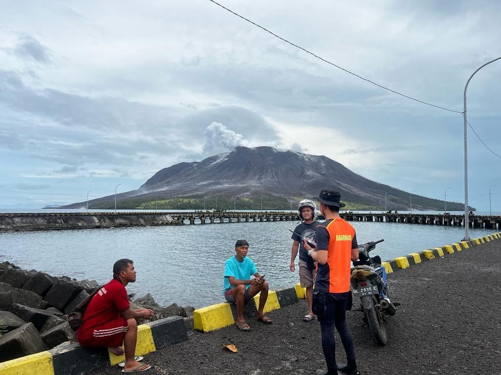
The SAR team has evacuated residents affected by the eruption of Gunung Ruang on the coast of Tagulandang Island in Sitaro Islands Regency, North Sulawesi, on Thursday (18/4/2014).
MAKASSAR, KOMPAS —The National Disaster Management Agency has asked regional governments around the Sitaro Islands Regency to declare emergency alert status. With this status, BNPB can immediately intervene and provide assistance if the impact of Mount Ruang's eruption spreads.
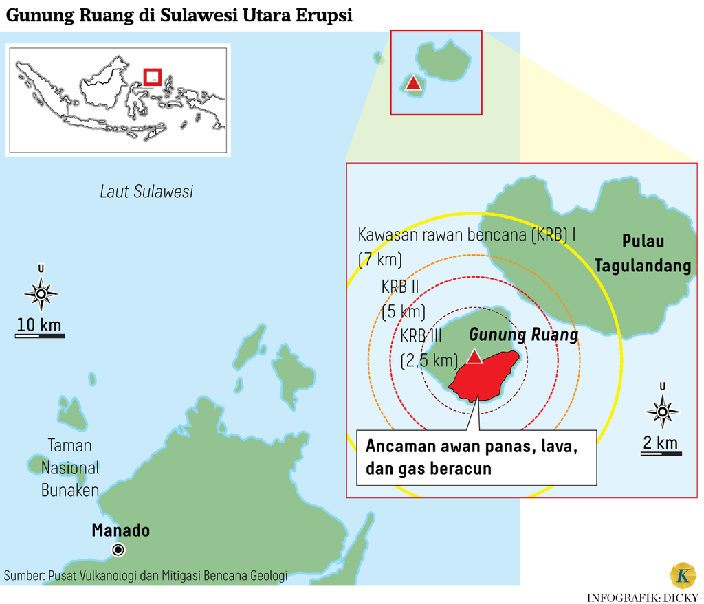
Previously, the Sitara Regency Government had declared an emergency response status following the increased status of Mount Ruang from Alert to Warning since Wednesday (17/4/2014) night. The area bordered by Sitara is the Sangihe Islands Regency to the north and the North Minahasa Regency to the south. Several pieces of information from Likupang, North Minahasa, indicate that volcanic ash has reached this area.
"If the condition of the volcano eruption continues to escalate, it is not only Sitaro that should declare a state of emergency. If possible, the surrounding areas or districts should also declare a state of high alert. There is no need for an emergency response. This is to ensure that if the impact spreads, the National Disaster Management Agency (BNPB) can immediately control and provide assistance," said the Head of BNPB, Lieutenant General TNI Suharyanto, in an online coordination meeting related to the eruption of Mount Ruang, on Thursday (April 18, 2014).
This meeting was attended by a number of related parties, including the Center for Volcanology and Geological Disaster Mitigation (PVMBG), North Sulawesi Provincial Government, Kodam XIII Merdeka, North Sulawesi Regional Police, Lantamal VIII Manado, and the Air Force and Sam Ratulangi Airport, as well as the Manado Basarnas Office.
Refugees on Tagulandang Island, Thursday (18/4/2024). After the eruption of a volcano in the Sitaro Islands Regency, North Sulawesi, on Tuesday night (16/4/2024), hundreds of residents were displaced.
Suharyanto emphasized that Law Number 24 of 2007 and Government Regulation Number 21 of 2008 are the legal basis for emergency response during disasters.
Regarding the unpredictable condition of Gunung Ruang, he urged all parties to increase their vigilance. This is because in emergency situations, there are thousands of residents in Sitaro who need to be evacuated.
"This condition requires the joint team to form a special evacuation team. Currently, residents are being evacuated gradually, especially those in the dangerous radius. Indeed, the situation is starting to subside, but we must always be prepared for the worst situation," he said.
Pangdam XIII Merdeka Major General TNI Candra Wijaya has stated that a team has been deployed along with assistance for the residents. However, due to unfavorable conditions, the ship was forced to first dock at Siau Island.
DOKUMENTASI KANTOR BASARNAS MANADO
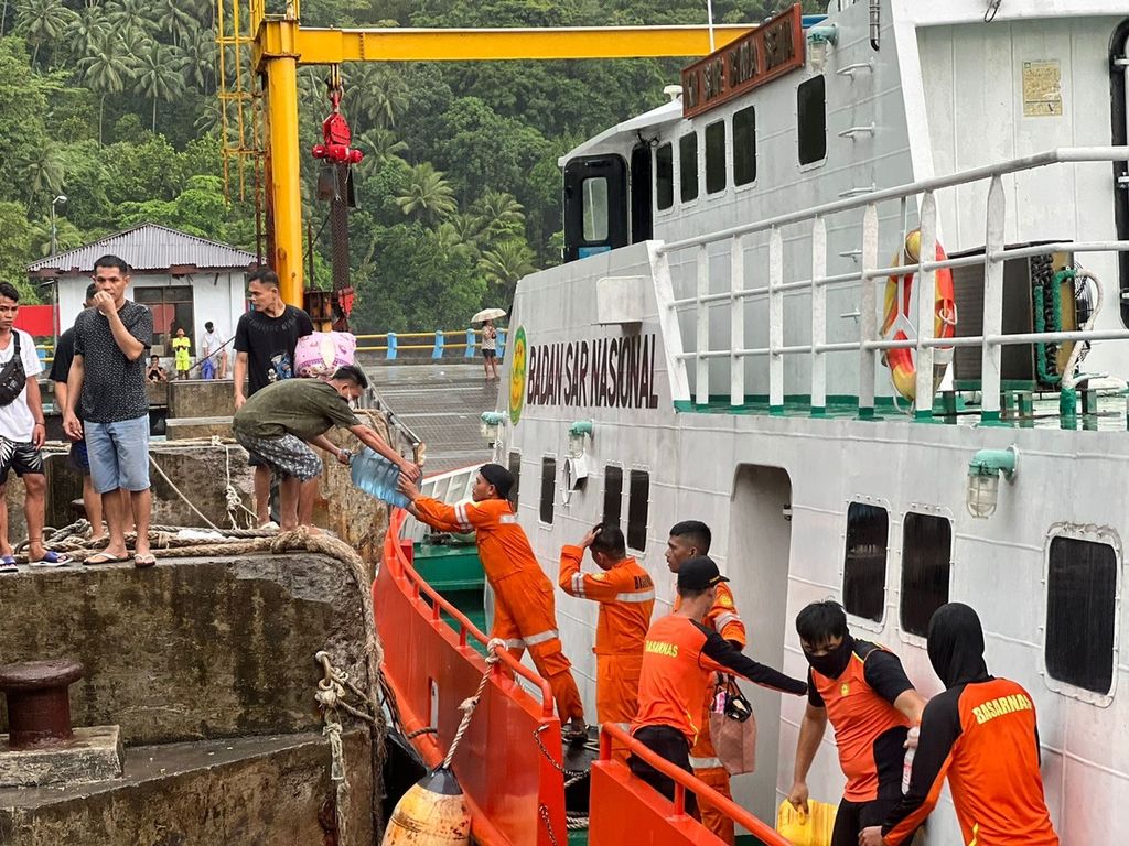
The SAR team evacuates residents affected by the eruption of Mount Ruang at Minanga Ferry Harbor, Sitaro Islands Regency, North Sulawesi, Thursday (18/4/2014).
"We are facing difficulties with transportation equipment. We don't have a helicopter. I am considering asking for helicopter assistance from the commander. As for the ship that is still in Siau Island, we will see if its condition allows it to continue to Tagulandang," he said.
Lantamal VIII Manado has deployed a ship carrying food aid, medication, as well as troops and volunteer teams. The same has been done by Polda Sulut by dispatching Brimob troops, Dokkes, as well as medication and food supplies such as rice, canned fish, eggs, and others.
Currently, due to the eruption of Mount Raung, Sam Ratulangi Airport is temporarily closed. The Sam Ratulangi Airport authorities stated that the nearest airport for logistics transportation is located in Siau Island, which is about 30 kilometers away from Tagulandang Island.
Since the first eruption occurred on Tuesday (16/4/2024) night, some residents have been evacuated to safe places on the mainland of Tagulandang Island. Following the escalation of Mount Ruang's status from alert to danger, evacuations continue to be carried out.
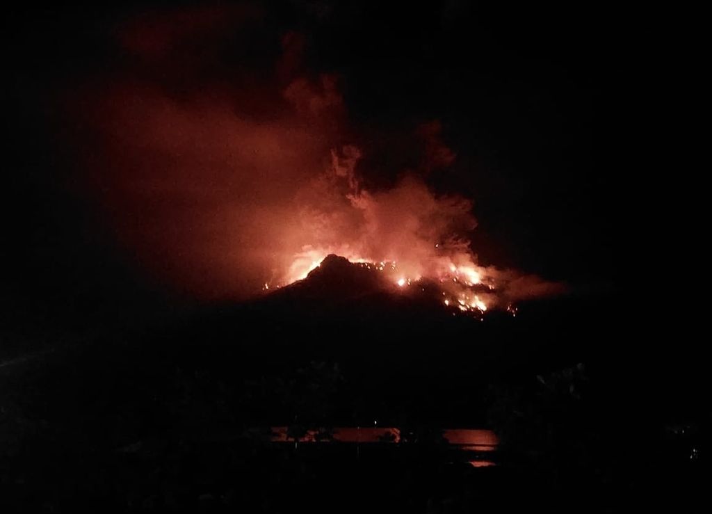
DOKUMENTASI BPBD SITARO
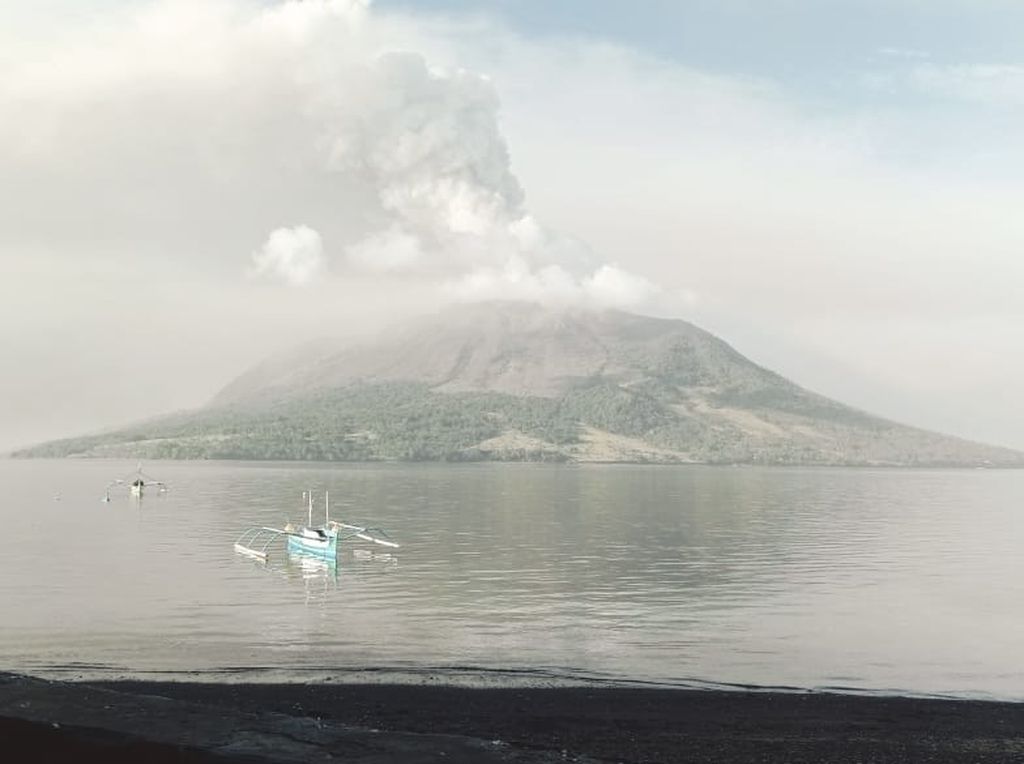
The condition of Mount Ruang in the district of Kepulauan Siau Tagulandang Biaro (Sitaro) in North Sulawesi, which erupted volcanic ash rain on Wednesday (17/4/2024).
Since Thursday morning, the SAR team has combed the coast of Tagulandang Island to retrieve residents. Following a major eruption on Wednesday night, many residents have taken self-evacuation measures.
“However, they are scattered and have no direction. Therefore, we used a rubber boat and were accompanied by KN Bima Sena to comb the coast and pick up residents who had to be evacuated. "We also moved ships and troops because last night the reach of material from the mountain had exceeded the safe limit," said Head of the Operations Section of the Basarnas Manado Office Jandry S Paendong.
Gilbert Santoso (28), a resident of Boto Village in Tagulandang District, said that until now they are still gathered at the evacuation location in the area.
"We want to evacuate, but we don't know where and who will pick us up. So for now, we're staying here. Last night during the eruption, my house was affected. The roof tiles were hit by rocks and were leaking. The situation has improved a bit now because it rained," he said when contacted on Thursday afternoon.
DOKUMENTASI BPBD SITARO
The eruption of Mount Ruang in the Kepulauan Siau Tagulandang Biaro (Sitaro) Regency in North Sulawesi occurred on Tuesday night (16/4/2024). Hundreds of residents were evacuated.
Editor:
NELI TRIANA
Share
Kantor Redaksi
Menara Kompas Lantai 5, Jalan Palmerah Selatan 21, Jakarta Pusat, DKI Jakarta, Indonesia, 10270.
Tlp.
+6221 5347 710
+6221 5347 720
+6221 5347 730
+6221 530 2200
Kantor Iklan
Menara Kompas Lantai 2, Jalan Palmerah Selatan 21, Jakarta Pusat, DKI Jakarta, Indonesia, 10270.