Neglecting Disaster Risks Renders Development Useless
›
Neglecting Disaster Risks...
Iklan
Neglecting Disaster Risks Renders Development Useless
The government is called upon to be prudent in spending on coastal development. Neglecting disaster risks will leave infrastructure development vulnerable to damage and could lead to the loss of lives.
By
·3 minutes read
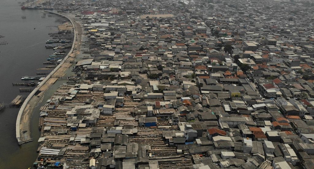
Kompas/AGUS SUSANTO
Tightly packed houses fill a densely populated residential area in Kalibaru, Cilincing district, North Jakarta, as seen on Friday (8/11/2019). The area was bustling with activity centered at the Kalibaru fishing port during the heyday of fishing trawlers in the 1960s. The area only has a port for shipping timber today, after the fishing port was closed in 1988.
JAKARTA, KOMPAS — The government is called upon to be prudent in spending on coastal development. Neglecting disaster risks will leave infrastructure development vulnerable to damage and could lead to the loss of lives. Public infrastructure development in hazard zones will also set a bad public precedent.
“The many earthquakes and tsunamis that have occurred in the last several years show that infrastructures can be rendered useless in mere minutes as a result of [ignoring and neglecting] scientific research,” Indonesian Tsunami Experts Association head Gegar Sapta Prasetya said in Jakarta on Thursday (21/11/2019).
Gegar said that disaster risks should be considered from the planning and location scouting stages in developing critical infrastructure and public facilities. The farther inland the structures were from the beach, the better it was. This was because not all risks involving earthquakes, tsunamis and soil liquefaction could be resolved through engineering and technology.
While seaports cannot be placed far from the coasts, airports can be located beyond tsunami hazard zones.
KOMPAS/FERGANATA INDRA RIATMOKO
The newly constructed main runway of Yogyakarta International Airport Waves lies perpendicularly to incoming waves along the coast of the South Java Sea in Kulon Progo, Yogyakarta, as seen on 24 April 2019.
Warning
In the case of the Yogyakarta International Airport development, Gegar said that experts had warned about the earthquake and tsunami hazards at the chosen location before the airport was built. They also recommended that the airport be located at some distance from the coastline, as several studies had found that tsunamis in the area could reach a height of 15 meters.
“However, the airport was still built right on the coast, meaning that the risk is incredibly high. Apart from threatening lives, this may also incur economic losses,” said Gegar.
At the “Strengthening Tsunami Early Warning at Vital Infrastructures” workshop earlier this week, Meteorology, Climatology and Geophysics Agency (BMKG) head Dwikorita Karnawati said that the agency had been involved in the development of Yogyakarta International Airport, and that tsunami and earthquake risks had been incorporated into the airport design (Kompas, 20/11/2019).
However, tsunami expert Widjo Kongko at the Agency for the Assessment and Application of Technology (BPPT) said that he had asked that the safety of the airport be evaluated, especially with regard to the area’s high risk of soil liquefaction due to its sandy soil and high groundwater table.
Liquefaction zone
The Energy and Mineral Resources Ministry’s Geological Agency has mapped the liquefaction hazard zone that places Yogyakarta International Airport squarely within a high-risk liquefaction zone.
The airport will surely be followed by other commercial and residential developments in the coastal area, neglecting spatial planning and [disaster] risks.
Eko Yulianto, the head of the Indonesian Institute of Sciences (LIPI) geotechnology research center, said that building Yogyakarta International Airport in a high-risk disaster zone set a bad precedent for the public. “The airport will surely be followed by other commercial and residential developments in the coastal area, neglecting spatial planning and [disaster] risks,” he said.
In addition to Yogyakarta airport, Kompas’ records show at least 16 other airports in Indonesia are situated in tsunami hazard zones.
Eko said that the government had never set a good example of considering risks in development projects. Other developments in southern Java that neglected disaster risks are the Pangandaran Integrated Aquarium and Marine Research Institute, Pangandaran Polytechnic and fish factories built by the Maritime Affairs and Fisheries Ministry.
A series of studies on paleotsunamis by Eko and his team has found evidence of a high recurrence of giant tsunamis in southern Java. (AIK)