Passengers disembark from a fast boat from Tidore Island at Bastiong Port, Ternate city, North Maluku, Monday (29/4/2019). The fast boats are vital transportation modes that connect the island region.
JAKARTA, KOMPAS — Heavy rains and high waves have the potential to re-hit parts of Indonesia over the next three days. The height of waves in the western waters of the Kei Islands and the eastern Banda Sea could reach 6 meters, making it dangerous for shipping.
Wind circulation has been detected around the eastern Banda Sea, which forms a wind accumulation in the western and central parts of Indonesia. This condition increases the potential for heavy rains in some areas.
Areas with potential for heavy rain in the next three days include North Sumatra, West Sumatra, Riau, Jambi, South Sumatra, Bengkulu, Lampung, East Java, West Nusa Tenggara, East Nusa Tenggara, North Kalimantan, East Kalimantan, Maluku, West Papua and Papua.
“People are encouraged to remain vigilant about the impacts, such as floods, landslides and flash floods,” Meteorology, Climatology and Geophysics (BMKG) deputy for meteorology R Mulyono R Prabowo said in Jakarta on Friday (03/05/2019).
Based on BMKG monitoring, the 1,009 hPa low pressure system appeared in the Sumbawa Sea to the Aru Islands. BMKG climate information and air quality subdivision head Siswanto said this low pressure system would strengthen to become a tropical cyclone so that the impact on the weather would be greater.
In addition to triggering heavy rain potential, this phenomenon also causes wind speeds of 3-20 knots, with the highest speed in the waters of the Tanimbar Islands and central and eastern Arafuru Islands. BMKG maritime meteorology division head Eko Prasetyo said the speed of this wind triggers high waves.
KOMPAS/TOTOK WIJAYANTO
Banda Naira fishermen in Central Maluku, Maluku, fish for tuna in the Banda Sea, Saturday (29/4/2019). They look for tuna by observing natural signs, such as dolphins going back and forth and birds flying in the area where groups of tuna gather.
Waves as high as 2.5-4 meters can occur in the waters of the Indian Ocean, from west of Aceh to the south of Java and Bali. This also has the potential to occur in the waters of the Tanimbar Islands and Letti Islands, the central and western Arafuru Sea and Seram Island. High waves with a very high category, namely 4-6 meters, are likely to occur in the western waters of the Kei Islands and the eastern Banda Sea.
Eko said wind speeds of more than 15 knots and waves above 1.25 meters posed a high risk to the safety of fishing boats. It will pose a risk for barges if the speed of wind is 16 knots and wave height is above 1.5 meters. For ferries, the risk will emerge if wind speed is more than 21 knots and wave height is above 2.5 meters. Meanwhile, for large-sized vessels, such as cargo and cruise ships, it is risky if the wind speed is more than 27 knots and wave height is above 4 meters.
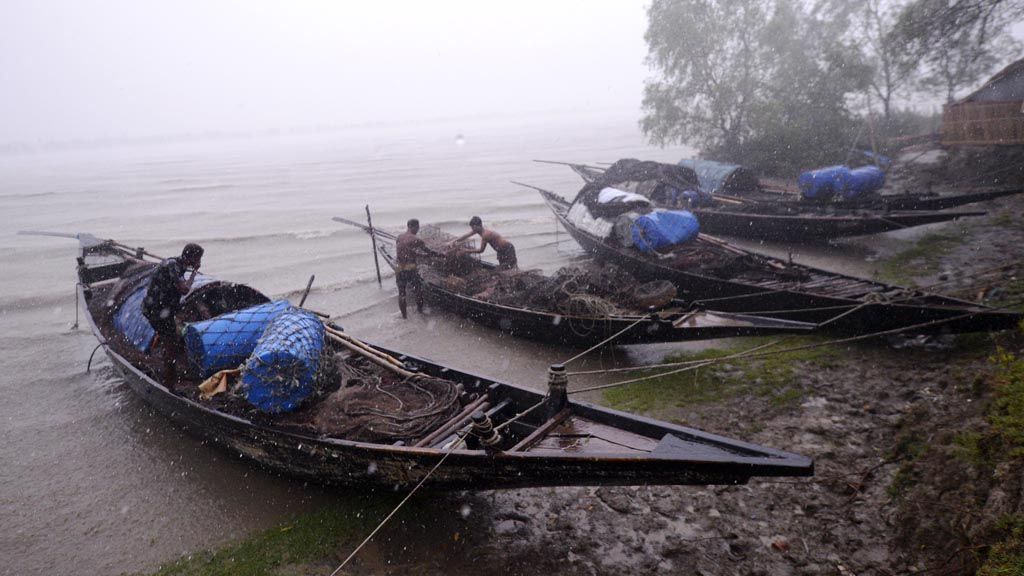
AFP/MUNIR UZ ZAMAN
Bangladeshi fishermen moor their boats in Khulna on May 3, 2019, as Cyclone Fani barrels northeastward into West Bengal state and toward Bangladesh. Two people died on May 3 after Cyclone Fani slammed into eastern India, officials said, as the storm sent coconut trees flying, blew away food stands and cut off power and water. The monster weather system, which made landfall at the eastern holy city of Puri in the morning, is one of the strongest to come in off the Indian Ocean in years, with winds gusting at speeds of up to 200 kilometers per hour.
Tropical cyclone
On a regional scale, the current weather conditions are also volatile. The Fani tropical cyclone, seen as the strongest in the last 20 years, has moved from the Bay of Bengal to the north, to the Indian mainland, and then turned northeast towards the Bangladesh region.
The Indian Department of Meteorology, as released by the World Meteorology Center, has issued a warning about the potential for very heavy rainfall in the regions of Odisha, North Andra Pradesh and West Bengal, as well as other states. This institution recommends evacuation of residents in coastal areas, total suspension of fishing operations, and the transfer or suspension of traffic.
As stated in the release, the cyclone Fani’s maximum wind vortex speed was 190-200 kilometers per hour or category 4 on the Saffir Simpson scale and drove up to 220 kilometers per hour. A storm surge as high as 1.5 meters above the highest tide is expected to inundate a low level in several districts in Odisha.
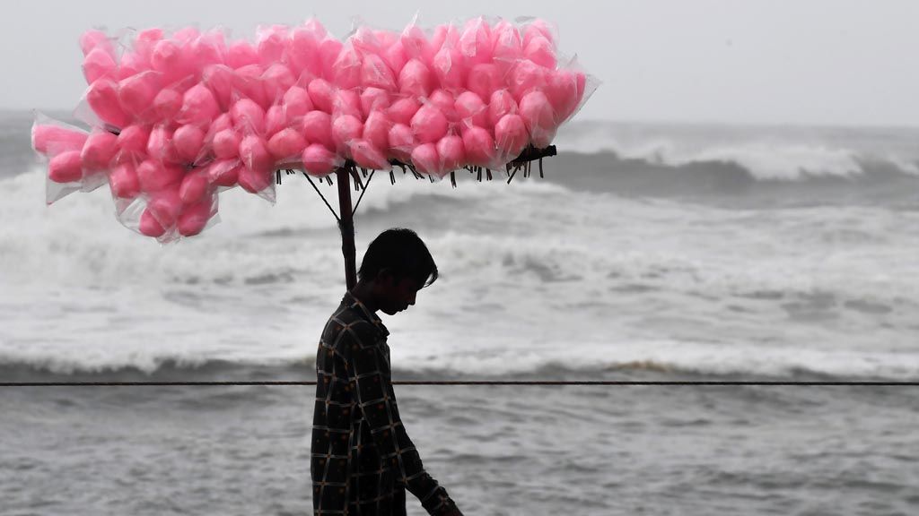
AFP/DIBYANGSHU SARKAR
An Indian candy vendor walks along a closed beach in Puri in the eastern Indian state of Odisha on May 2 as cyclone Fani approaches the Indian coastline. Nearly 800,000 people in eastern India have been evacuated ahead of a major cyclone packing winds gusting up to 200 kilometers per hour and torrential rains, officials said on May 2.
Data from the World Meteorological Organization (WMO) shows that strong cyclones repeatedly occur in the Bay of Bengal and hit the east coast of India. Generally, this cyclone occurs in the end of the monsoon season in November, not in April. Data showed, in the 1965-2017 period, of the 46 destructive cyclones in the region, only two occurred in April. (AIK)